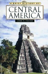
Central America
Costa Rica ° El Salvador ° Guatemala ° Honduras ° Nicaragua
° Nicaragua Canal
Panama:
° Aspinwall
° Cruces
° The Canal
° Panama Railroad
International Harbors
May 2, 1854, Sacramento Daily Union, Sacramento, California
Costa Rica
— An Interesting Account of the Country
Capt. Lawrence, of the barque St. Marys, recently arrived from Costa Rica, furnishes us with the following very interesting account of this country, its products, trade and commerce. — Alta California.
San Francisco, April 29, 1854.
Mr. Editor: — Having just, arrived from Punta Arenas, Costa Rica, and as that prolific' country seems to be comparatively little known to you of California, I take the liberty of transmitting to you a short account of some of its features which, I believe, will eventually be of considerable importance to the mercantile and other interests of this country.
Costa Rica is a coffee growing country, the quality of which stands higher in Europe than any other coffee in the world. It brings better prices on the Continent and in England than the celebrated Mocha coffee. California being the nearest point for this article, it must command a preference for the coffee grower of Costa Rica, both on account of the diminished cost for carrying, when compared with a voyage to Europe, as well as the quick return, which is a very great object. At present, eight months, and even more, are consumed before returns are had, when the article is shipped to Europe.
Punta Arenas, Costa Rica
So far as natural advantages go, there are few countries that can equal and none surpass Costa Rica. Having occasion whilst lying at Punta Arenas, to visit San Jose, the capital of the State, some ninety miles in the interior, I found the country bordering my path, although the worst season of the year, more like a magnificent moving panorama than a reality. In rising the Mount Aqua Gato, both sides exhibited one continued mass of luxuriance, producing, together with the most delicious tropical fruits, some of the largest and finest trees I ever saw, the timber of which is very valuable. Now and then the gurgling noise of some silver stream would break upon the ear, as it wound its way through the majestic forest, or tumbled from rock to rock down the mountain side, until at last both stream and sound were lost in the distance.
Plateau and Volcanoes of Costa Rica. 1885.

After gaining the summit of the mountain, the most beautiful sight man could wish to behold was spread out to view. A sudden turn in the road brings in sight the valley of San Jose, extending on every side as far as the eye can reach. Here and there in the vast sea of luxuriant growth, a coffee plantation is dotted, whilst all else impresses the mind with the idea of a highly cultivated flower garden. Although Nature has lavished her gifts in such bounteous profusion, but a small portion of the advantages she offers are improved by the inhabitants from their general indolence.
This year in Costa Rica more than 50,000 quintals of coffee will spoil on the trees from the want of laborers to pick. There are inhabitants enough, but they prefer living on the natural productions of the soil to making exertion for anything more. The amount of about 80,000 quintals of coffee will be gathered this season, the principal part of which will be shipped to England, speculators having generally engaged it of the grower before it is gathered to be delivered at Punta Arenas The return ships bring out such goods and manufactures as the planters require.
This country also raises some of the best quality of cocoa, which might be extensively grown if proper attention were given to it. Tobacco also grows well, one quality of which is fully equal to the best principe. Wheat, rice and sugar grow with the least cultivation.
Fine cattle are raised, the most of which is of a superior quality. Hogs and poultry are raised in abundance; and vegetables of all kinds are grown with but little attention. The mountains furnish an abundance of marble and slate. Coal is reported to exist to a certain extent. Several gold mines arc now worked, which, if the late improvements in this kind of mining were introduced, would, no doubt, pay largely. For useful and valuable timber this country can hardly be equalled, some kinds of the trees affording the most lasting wood known. Many of the fancy woods are unknown out of the country. Some of these have the appearance of being inlaid with other varieties ; some exhibit a beautiful blending of colors, and look more like the work of art than the product of nature.
The climate is healthy, the thermometer generally ranging between 80 and 85 degrees Fahrenheit. The rainy season lasts but little over three months. On the Gulf of Mexico border of this State, the finest oysters and fish are found, and to my taste they seemed the best I had ever eaten. These delicacies form the principal articles of consumption of the inhabitants. The principal and best harbor on the Pacific Ocean is Punta Arenas, which offers the best opportunity for repairing shipping, as far as natural advantages tend, wanting only mechanics to do the work. This species of work could be made to pay handsomely, and should a trade spring up between this country and Costa Rica, the harbor of Punta Arenas will assume an additional importance from the natural advantages offered for repairing, &c, &c.
At some future time I will give you an account of some other matters in relation to this country, but at present fearing I have trespassed too much upon your time and space, I am your truly,
James P. Lawrence,
Master bark St. Mary.
April 12, 1856, Mountain Democrat, Placerville, El Dorado County, California
From the Washington Globe.
Central America
Perhaps no part of our continent was less known to the general reader twenty five years ago than Central America; and even now, when the occurrence of so many strange and unexpected events has, within a few years, given it an unusual degree of importance, we are comparatively uninformed as to its geography or history. The larger Provinces of Spain, all of which, together with the States of Central America, became independent of the mother country at about the same time had been long known to the world, on account of their great natural wealth, and the number of soldiers and travelers who thronged thither in search of gain or wild adventure; but the States of Central America, having no special attractions for strangers, and having gained their independence without a struggle, by a quiet declaration, remained in obscurity.
 |
1733 Costa Rica, Mexico, Central America |
The discovery of gold in California made a wonderful change. To reach the land of gold the readiest and shortest route was over the Isthmus of Panama, and immediately it became a second time a thoroughfare for the nations of the world, as it had been three centuries before for adventurers to the first El Dorado Peru.
For citizens of the United States and Great Britain, Central America has for years had special interest, as being designed for the local application of the celebrated Monroe doctrine, and as being particularly referred to in the equally celebrated Clayton-Bulwer treaty, and recent wild rumors point to it as destined to be the means of inching the two nations in a war to sustain or destroy forever the fundamental principle of that doctrine and treaty, and to decide the commercial sovereignty of the world.
The territory of the Slates of Central America, formerly termed the Kingdom of Guatemala, has, since its separation from Spain, been considerably diminished by the encroachments of its more powerful neighbors It extended originally from the eastern part of Chiriqu (Escudo de Veragua), where it joined the present State of New Grenada on the south-east, to Mexico on the north-west; a distance of more than 600 leagues overland...
It has been well said of Central America, that in its physical aspect and configuration it is an epitome of all other countries and climates on the globe. A chain of mountains passes through it in a direction nearly parallel to the northwest coast, and nearer to the Pacific than to the Atlantic. These mountains are not so high as those in North or South America, their mean altitude being from live thousand to seven thousand feet; though in some parts of Costa Rica they reach a height of nine thousand feet, and the Volcano de Apua, or water volcano, is fifteen thousand feet high, being the highest land in Central America. No other country of the same area, except perhaps Java, has so many active volcanoes. A great variety of climate is caused by the constant alteration of mountain and valley; branches from the main range diverging in different directions, so that large plains are nowhere found.
There are mines of gold, silver, iron, lead, and mercury; but none of these metals are found in large quantities. Limestone and quartz are very scarce. Lime and building stone are obtained on the Atlantic from coral rocks. On the Pacific, lime is made from shells. Jasper and marble are worked in Honduras, and sulphur is collected near some of the volcanoes. On the Pacific coast large quantities of salt are procured from springs, which are numerous.
Though Central America is within the torrid zone, its climate is comparatively mild, and in many parts very salubrious. According to Baily, the greatest mean temperature in the interior is 68 , and on the coast from 82 to 84. According to other authorities, the thermometer occasionally rises to 86 in March and April, but ranges generally from 74 to 82 at noon . . .
As a consequence of the remarkable fertility of the soil and the great varieties of temperature, almost all the tropical productions and many that are peculiar to the temperate zone are raised in great abundance. The grains, vegetables, and fruits of Europe are raised in the higher parts of the table lands. Almost all kinds of articles of substance abound, together with all wild and tame animals commonly used as food. In the lower and warmer districts, Indian corn, the sweet potato, sugar cane, indigo, tobacco, cocoa, cochineal, banana, mandioca, and almost all tropical fruits, flourish, including the cherimova, said to be the most exquisite of all fruits.
Besides these articles, the principal commercial productions are coffee, rice, cotton, wool, hides, many dye-woods drugs, balsam, and various gums, timber, minerals, and precious stones. The coffee crop of Costa Rica, in 1852, was ninety thousand quintals.
The people have been content to accept what the unaided fertility of the land bestows upon them. It results from this, that where go many commodities could be abundantly raised, only three or four are exported, all others being produced only in sufficient quantities for home consumption. As a melancholy instance of the violent opposition of the ignorant masses to the modern improvements in agriculture, commerce, and manufactures, it is related by Squier that Don Gregorio Yenerio, a man of intelligence and public spirit, who had introduced new improvements in agriculture and new machinery in the manufacture of cotton and the preparation of cotton and indigo for foreign markets, was murdered in cold blood, in the presence of his entire family, by a band of robbers and assassins, led by the robber chief Somoza. This occurred but a few years back.
On the east coast the ports are:
- Belize, Santo Tomas and Izabal, in Guatemala;
- Cabo Caballo, Omoa, Coxenholo and Truxillo, in Honduras;
- Cape Gracias a Dios, Bluefields, and San Juan, in Nicaragua;
- Matma and Boco del Torro, in Costa Rica.
On the Pacific are:
- Golfo Dolce, Punta Arenas and Caldera, in Costa Rica;
- the bays of Culebra, Salinas, San Juan del Sur, Tamarinda and Realejo, in Nicaragua ;
- Amapalo and San Lorenzo, in Honduras;
- La Union, Jiguilisco, Acajutla and Sonsonate, in San Salvador,
- Istapa and Ocus, in Guatamala.
Four of the five States now have ports on both oceans, San Salvador being the only one whose maritime commerce is, limited to the Pacific.
Coffee, also, said to be equal to any in the world, is produced; yet it is exported only by Costa Rica. It is the chief source of wealth to this State, the crop of 1847 amounting to eight million pounds, worth $1,000,000. Trade is free alike to foreigners and natives. The ordinary revenue of the States is derived from duties or imposts, a duty of five per cent on the transfer of real estate, and a monopoly of the bale of spirits and tobacco. As no returns of the commerce of the several States, except Costa Rica, have been made for many years, it is impossible to arrive at any certain information in regard to it.
In 1845, the exports of Costa Rica amounted to $631,700, its imports to $163,000, and the net revenue of the government to $132,000.
1899. World's Fleet. Boston Daily Globe
Lloyds Register of Shipping gives the entire fleet of the world as 28,180 steamers and sailing vessels, with a total tonnage of 27,673,628, of which 39 perent are British.
| Great Britain | 10,990 vessels, total tonnage of 10,792,714 |
| United States | 3,010 vessels, total tonnage of 2,405,887 |
| Norway | 2,528 vessels, tonnage of 1,604,230 |
| Germany | 1,676 vessels, with a tonnage of 2,453,334, in which are included her particularly large ships. |
| Sweden | 1,408 vessels with a tonnage of 643, 527 |
| Italy | 1,150 vessels |
| France | 1,182 vessels |
For Historical Comparison
Top 10 Maritime Nations Ranked by Value (2017)
| Country | # of Vessels | Gross Tonnage (m) |
Total Value (USDbn) |
|
|---|---|---|---|---|
| 1 | Greece | 4,453 | 206.47 | $88.0 |
| 2 | Japan | 4,317 | 150.26 | $79.8 |
| 3 | China | 4,938 | 159.71 | $71.7 |
| 4 | USA | 2,399 | 55.92 | $46.5 |
| 5 | Singapore | 2,662 | 64.03 | $41.7 |
| 6 | Norway | 1,668 | 39.68 | $41.1 |
| 7 | Germany | 2,923 | 81.17 | $30.3 |
| 8 | UK | 883 | 28.78 | $24.3 |
| 9 | Denmark | 1,040 | 36.17 | $23.4 |
| 10 | South Korea | 1,484 | 49.88 | $20.1 |
| Total | 26,767 | 87.21 | $466.9 | |

Site Search

Birds of Tortuguero and the Caribbean Coast
Robert Dean.

Aspinwall Empire
(Maritime)
Col. Duncan S. Somerville.

The Building of the Panama Canal in Historic Photographs
Ulrich Keller

The Panama Canal: A History of One of the Most Difficult Engineering Projects Ever
James K. Wheaton

The Big Ditch: How America Took, Built, Ran, and Ultimately Gave Away the Panama Canal
Noel Maurer